

mina

Description of mina
This drainage application allows users to livestream video, create maps and store/share survey reports by simply linking your Android device to your Wi-Fi enabled pipeline inspection system.
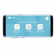
mina has three main functions:
1: Create Detailed Overview Maps
- Using Google Maps, plot a clear and accurate site survey overview. Taking away the need for you to draw a rough map on a scrap of paper, instead you can snap a screenshot of the site you are surveying and overlay it with coloured text and lines.
- Plot industry recognised icons to mark key attributes from your survey. Take them straight from the library of itemised icons including “manhole”, “rodding eye”, “catchpit”, “road gully” and many more.
- Use standard smart device technology gestures with mina. Pinch, expand and rotate your map and icons to create the most accurate survey map.
2: Wireless Connectivity
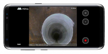
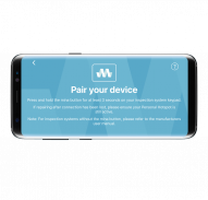
- By linking your Android device to your Wi-Fi enabled inspection system (currently only available for Maxprobe and Explorer models), you will be able to live stream your inspection system display and control its functions remotely.
- This gives users the ability to duplicate the video feed to a nearby Android device, and control the Start/Stop Record feature, Camera Light Level and Meterage settings.
3: Report Sharing
- Import sitemaps into embedded mina or WinCan software on your pipeline inspection system and create a full PDF Report.
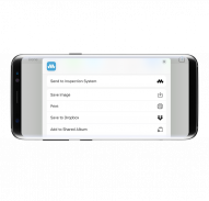
- Export complete mina or WinCan PDF reports from your inspection system direct to your Android device via the mina app. These can be stored, viewed or shared via the devices sharing applications or emailed to your personal contacts.


